Watershed-Based Floodplain Management
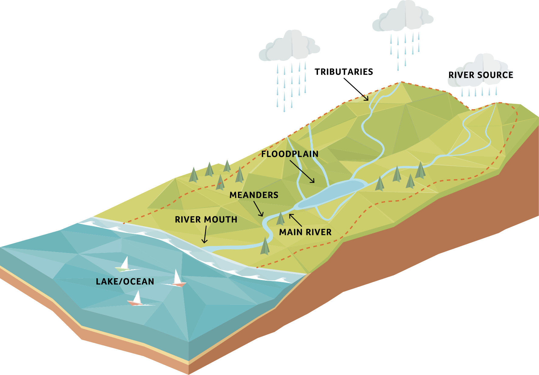
What is a Watershed?
The U.S Geological Survey describes a watershed, often referred to as a drainage basin or catchment, as the geographic area within the boundary of a drainage divide, which drains all the streams and rainfall to a common outlet.
Watershed management typically involves water quality and pollution control, ecosystem management and river management.
What is a Floodplain?
FEMA’s National Flood Insurance Program defines a floodplain as “any land area susceptible to being inundated by floodwaters from any source.”
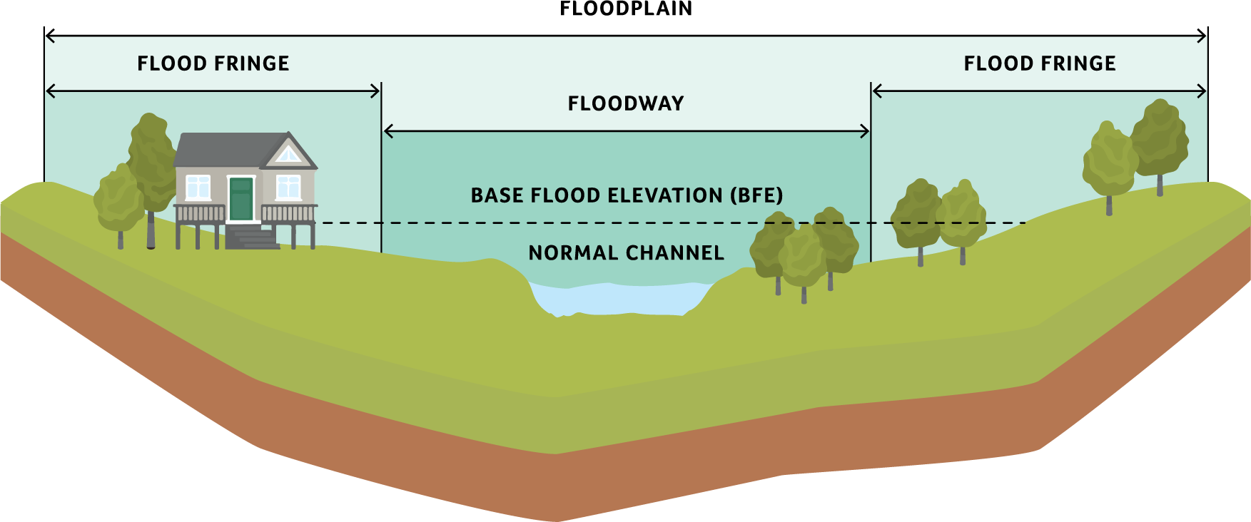
Floodplain management typically involves implementing building standards and regulating development in flood-prone areas.